
CSIRO Disaster Assessment Surveyor System (DASS)
Photograph: Peter Baker.
Domain: emergency management and post-disaster impact assessment · Deployment: available nationally for emergency management agencies · Scale: national, co-developed with state, territory and national agencies · Year: 2024 onwards
A national approach to post-disaster impact assessment
CSIRO researchers have a long history of informing and performing post-bushfire impact assessments. As weather extremes and natural disasters become less predictable and more frequent, the tools we use to perform these assessments must evolve.
During the 2019/20 Black Summer fires, fire agencies faced significant hurdles in undertaking comprehensive surveys across a large portion of the affected area. The Royal Commission into National Natural Disaster Arrangements, published in 2020, described these challenges in detail, and identified the need for nationally consistent approaches and tooling to streamline collection and collaboration across borders and between agencies.
The DASS is a post-disaster impact assessment platform, available nationally for emergency management agencies. The platform was co-designed in a series of working groups, interviews and user-tests, with emergency management representation from across the country.
The initial application of the DASS was for post-bushfire impact assessment; however, funders, stakeholders and users identified the potential for the tool to support multi-hazard assessment. In response, CSIRO is adopting a multi-hazard approach and beginning to expand the national library of templates to include assessments for other hazards.
Funding and development of the tool sits under the National Bushfire Intelligence Capability, which CSIRO leads. Stage 3, covering the 2025/26 and 2026/27 financial years, is funded by the Australian Government through the National Emergency Management Agency (NEMA). Stage 2 was funded by the Australian Government through the Australian Climate Service.
What the platform does
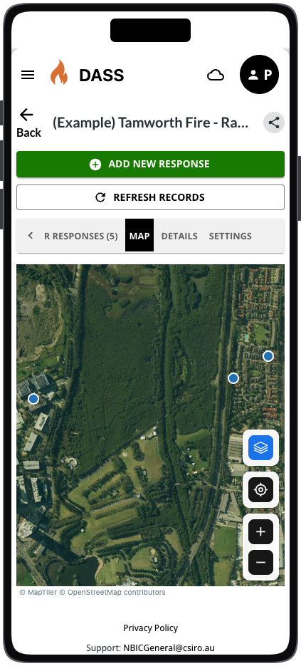
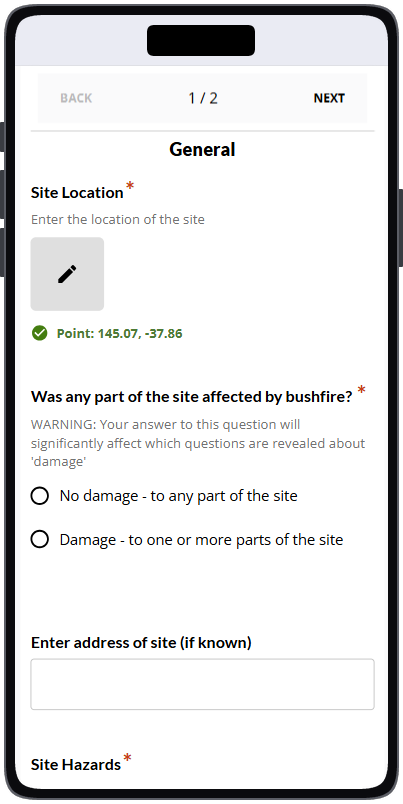
DASS comprises two integrated tools. The offline-capable mobile app handles rapid onboarding and data collection for both initial and detailed assessments. The browser-based system manages users, teams, invites, templates, surveys, access permissions, and data export, and carries two ready-made customisable templates, with a growing library of national templates.
The ‘Second Sweep’ survey is a detailed and comprehensive structural impact assessment. The ability to synchronise records in real time means field teams have increased situational awareness during collection campaigns.
CSIRO identified the potential of FAIMS3, the open-source tool which powers Fieldmark®, to offer a solid base for a field-ready data collection tool. FAIMS3 has a strong offline-capable architecture which makes it suitable for environments where a stable internet connection can’t be relied upon. The collaboration between Fieldmark and CSIRO has helped to significantly strengthen and expand the capability of FAIMS3.
In their words
The National Bushfire Intelligence Capability (NBIC), delivered by CSIRO and funded by NEMA, has developed the DASS tool to increase the national consistency, accessibility, quality and scalability of post-disaster impact assessment. Building on an open-source tool means that we can leverage the existing significant capability, and investments by the Australian Research Data Commons (ARDC), Macquarie University, CSIRO, UNSW, and other partners in Australian research tools. Collaborating with Fieldmark to build a sustainable, open-source platform means we can increase the accessibility and efficiency of digital tools.
Building on the open-source platform, which powers Fieldmark, means that the DASS platform can collaboratively invest in a shared national research capability, while providing a rapid pathway to impact for the emergency management sector. The powerful user-facing customisation that the platform provides means that we can provide nationally consistent collection templates, which can be rapidly fine-tuned for agency specific needs. The DASS has proven to be a fit-for-purpose platform; with a reliable, multi-platform in-field collection app and a highly customisable design, it is capable and adaptable enough to meet our objectives, now and in the future.
Peter Baker, Project Leader of the DASS, National Bushfire Intelligence Capability, 8 October 2026.